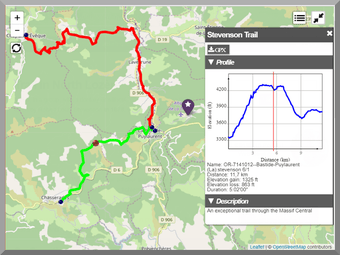
Interactive GPX Track Display Plugin for WordPress
Lf Hiker is a versatile WordPress plugin designed for outdoor enthusiasts who want to showcase their GPX tracks on interactive maps. It allows users to easily upload GPX files through the WordPress media manager, customize track information, and insert them into posts or pages using shortcodes. The plugin supports multiple map types, including OpenStreetMap and topographical options, providing a comprehensive view of trails with detailed elevation profiles and other essential data.
Key features include the ability to display multiple GPX files on the same map, customizable markers, and various map settings to enhance user experience. Users can adjust attributes such as stroke color, width, and unit measurements for elevation and distance. With responsive design and support for multiple languages, Lf Hiker is a valuable tool for anyone looking to share their hiking adventures and trail information effectively.